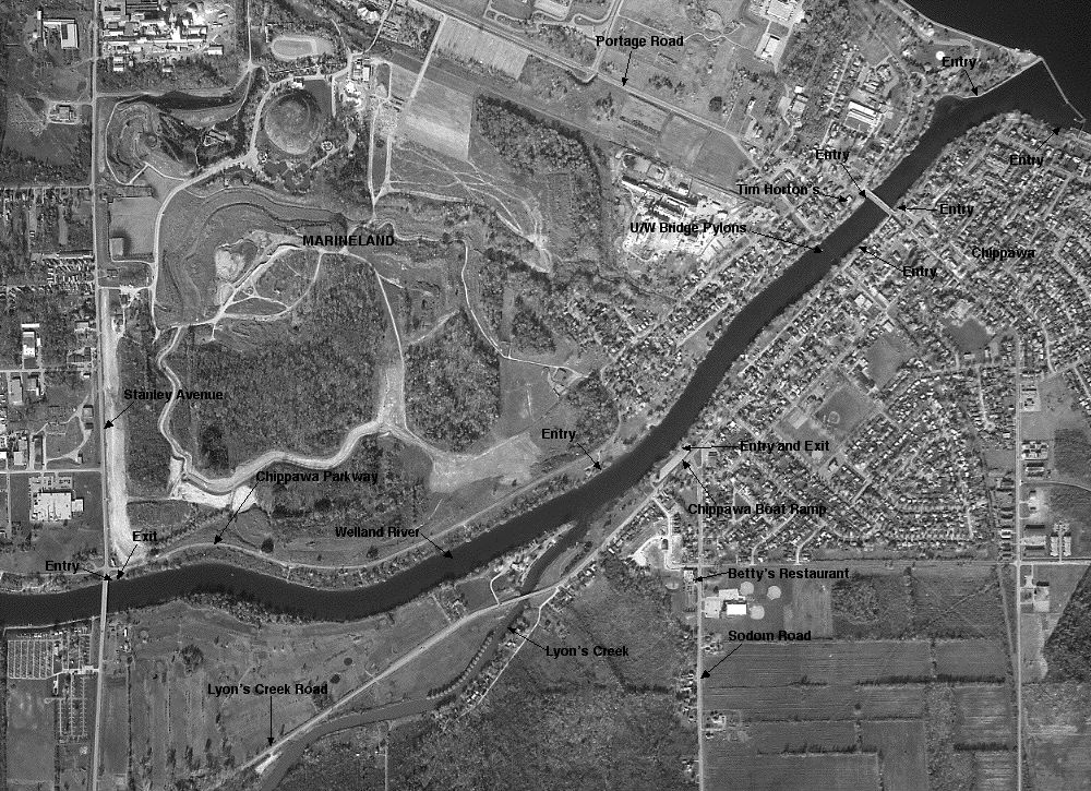
Chippawa Creek
Air Photo
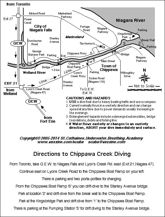
Chippawa Creek
in Niagara Falls

West Park Pool
in St. Catharines

Windmill Point
Wreck
|
Chippawa Creek Air Photo |
Chippawa Creek in Niagara Falls |
West Park Pool in St. Catharines |
Windmill Point Wreck |
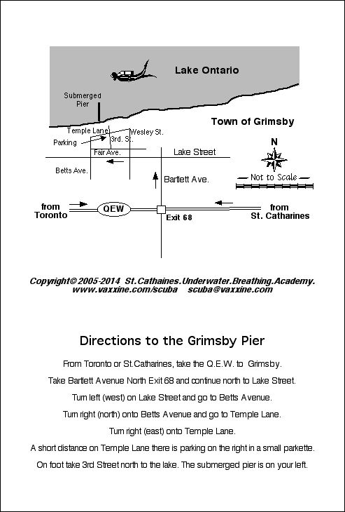
Grimsby Pier in Grimsby |
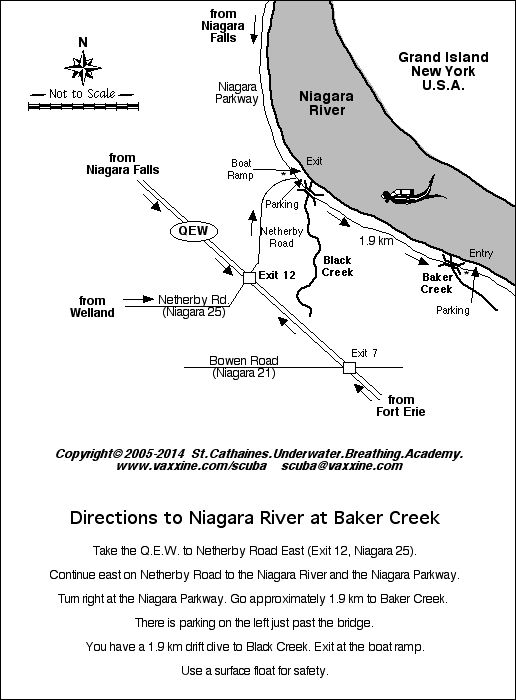
Niagara River at Baker Creek |
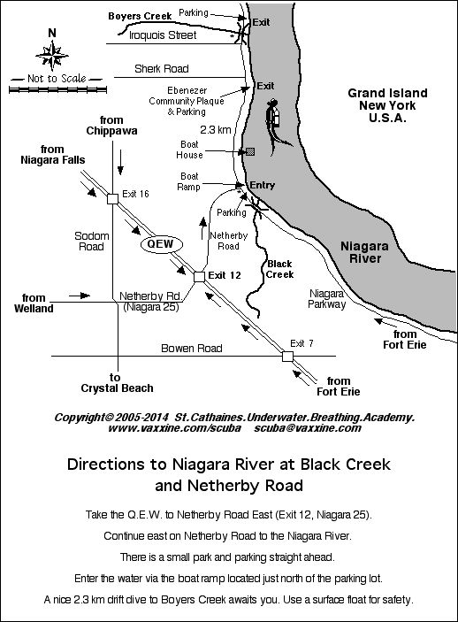
Niagara River at Black Creek |

Niagara Shores Park Niagara-on-the-Lake |

Port Colborne Boat Ramp |

Port Colborne Canal West Wall |
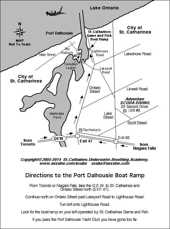
Port Dalhousie Boat Ramp |
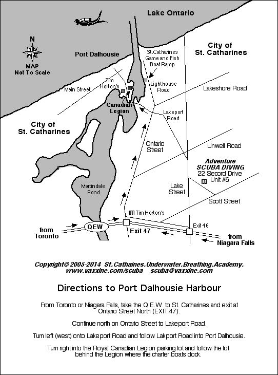
Port Dalhousie Harbour |

Sherkston Shores and Quarry |
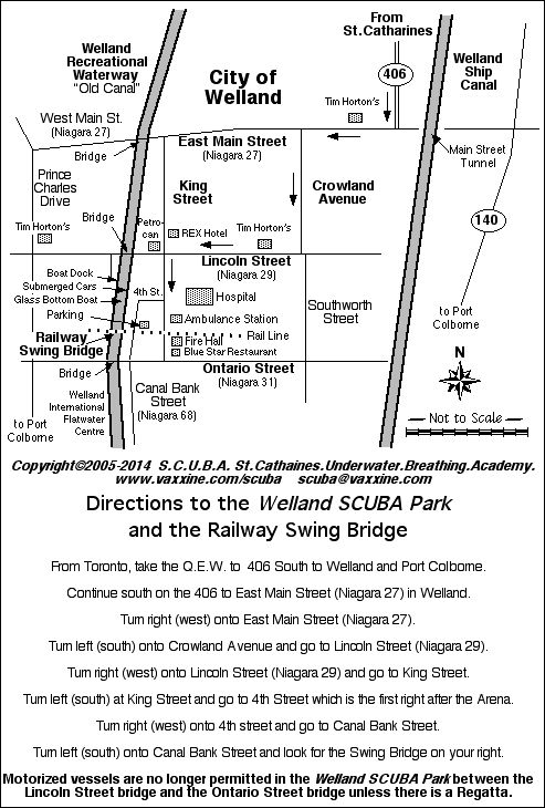
Welland SCUBA Park Swing Bridge |

Wellland SCUBA Park Boat Dock |

Windmill Point Park and Campground |
|
Navy Hall in Niagara-on-the-Lake |
Niagara River at Frenchman's Creek |